Cape Breton’s bedrock isn't a single uniform mass. The island sits on a complex collage of pre-Carboniferous metasediments, granitic plutons, and fault-bounded Carboniferous basins. Drill crews working the Sydney Coalfield know how abruptly sandstone gives way to shale, but what lies between boreholes is where seismic tomography earns its keep. Our field team uses 24- to 48-channel seismographs with 4.5 Hz geophone arrays to map P-wave and S-wave velocity contrasts across the site. The resulting tomograms show exactly where rippable overburden stops and competent rock begins. For foundation design near the Bras d'Or Lakes, where glacial till overlies karst-prone Windsor Group gypsum, a resistivity survey often complements the seismic profile to flag dissolution features that velocity data alone can miss.
A velocity tomogram replaces speculation about subsurface geometry with a measured cross-section you can hand to your excavator operator.
Process and scope
Local considerations
We often see groundwater issues in the Mabou Group and Horton Bluff Formation that surface mapping never flags. A seismic refraction line run across a proposed cut slope can reveal a water-saturated fracture zone at 8 m depth that would turn a routine excavation into a stability problem. The P-wave velocity drops sharply in saturated, fractured rock, and that signature is unmistakable on a processed tomogram. Without it, you don't know it's there until the slope starts moving. Combined with slope stability analysis, the velocity model gives you a defensible basis for cut angles and drainage design. On wind farm access roads in the Cape Breton Highlands, this combination has kept projects on schedule through spring thaw when groundwater pressures peak.
Applicable standards
The applicable standards include ASTM D5777-18, NBCC 2020 for seismic site classification, CSA A23.3 as a foundation design reference, and ASTM D7400-19 for downhole seismic testing.
Related services
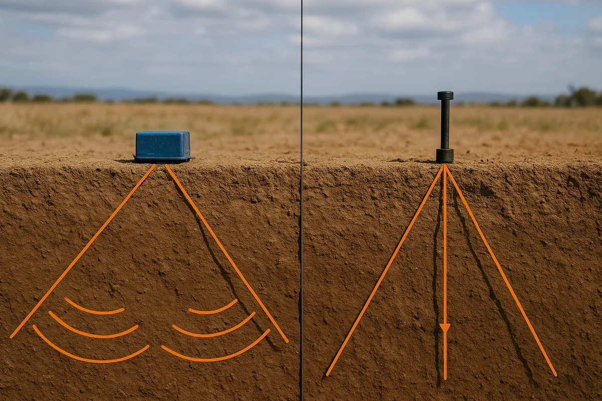
Seismic Refraction Tomography for Excavation Planning
We map overburden thickness, bedrock competence, and rippability across your site. Deliverables include P-wave velocity tomograms, interpreted bedrock surface contours, and a rippability classification tied to Caterpillar D8/D9 performance charts. Typical projects: building foundations, trench alignments, quarry development.
Seismic Reflection for Deep Bedrock and Basin Structure
When target depth exceeds 40 m, reflection profiling images stratigraphic boundaries and fault geometry with higher resolution than refraction. We use 24-channel CDP acquisition with vertical stacking. Applications include tunnel feasibility, deep aggregate exploration, and mapping the base of Carboniferous basins.
Typical parameters
Questions and answers
What does a seismic refraction survey cost on Cape Breton Island?
How deep can seismic refraction see in Cape Breton glacial till?
With a sledgehammer source and 48-channel spread, we typically reach 25 to 35 m depth in competent till and bedrock. An accelerated weight drop pushes that to 60–80 m. The real limit is the velocity contrast—if the till is acoustically slow and the underlying granite is fast, depth penetration is excellent. If you need deeper targets, reflection profiling is the better tool.
Can you run seismic lines on pavement or inside buildings?
Yes, with adjustments. On asphalt or concrete, we use steel baseplates with epoxy-bonded geophones or plant sensors in adjacent soil strips. Inside industrial buildings, we run lines before equipment installation or during shutdowns. The main constraint is coupling—we need firm contact between sensor and ground. Loose gravel or thick organic soil requires burying geophones a few centimetres.