The ground conditions across Cape Breton shift dramatically when you move from the sedimentary basins around Sydney toward the highland granites of the Cabot Trail corridor. In the low-lying areas near the Mira River, we often encounter thick sequences of glacial till and compressible silts that tell one seismic story; up on the slopes of Boisdale or Baddeck, shallow bedrock and fractured metasediments tell something entirely different. That contrast is precisely why a standard borehole log alone cannot define the site class under NBCC 2015. We run active and passive MASW surveys to capture shear wave velocity profiles that reflect the real stiffness of the ground column at each Cape Breton site, giving structural engineers the VS30 value they need for seismic design without overbuilding or cutting corners.
In Cape Breton's glacial terrain, VS30 can shift from 280 m/s to over 600 m/s across a single building footprint — a difference that changes your NBCC site class from D to C.
Process and scope
Local considerations
Cape Breton sits within a region of moderate seismic hazard that many local builders underestimate. The 1929 magnitude 7.2 Grand Banks earthquake generated felt shaking across the island, and while the seismicity is lower than the Charlevoix or Cascadia zones, the NBCC 2015 spectral accelerations for Sydney are not negligible — Sa(0.2) values reach 0.12 to 0.18 g depending on the specific coordinates. The real problem is the soil column. Soft estuarine clays and loose deltaic sands along the Sydney River floodplain can amplify ground motion significantly, pushing a site toward Class D or even Class E without the owner realizing it until the foundation design is already locked. Relying on the default Class C assumption in NBCC Clause 4.1.8.4.(3) for sites without geophysical data is a gamble we have seen backfire during plan review. A measured VS30 eliminates that uncertainty, and in borderline cases where the velocity profile places the site right at the Class D/E boundary, the field data lets the structural team decide whether to proceed with site-specific response analysis or adjust the design spectra conservatively.
Applicable standards
ASTM D4428/D4428M-17 (Crosshole and Surface Seismic Testing), NBCC 2015 Division B, Clause 4.1.8.4 (Site Classification for Seismic Design), ASCE/SEI 7-22 Chapter 20 (Site Classification Procedure — referenced for comparative analysis), and CSA A23.3-14 Annex K (Seismic design of concrete structures — site class input) were employed.
Related services
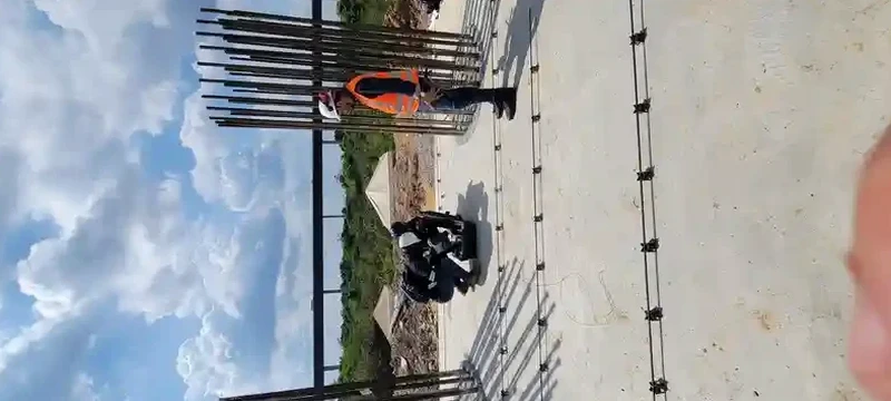
VS30 Site Classification Survey
Active-source MASW line with 24-channel array, optimized for 30-metre investigation depth. We deliver a complete dispersion curve, inverted shear wave velocity profile, and NBCC site class letter within one week. This package covers most Part 4 building designs and is accepted by municipal building officials in Cape Breton Regional Municipality without additional justification.
Deep Passive-Array Profiling
For tall structures, bridges, or sites with suspected deep soft zones exceeding 30 metres, we combine active MASW with passive horizontal-to-vertical spectral ratio (HVSR) recording. The passive array runs 30 to 60 minutes of ambient noise, resolving velocity structure down to 80–100 metres. This approach is particularly useful where the NBCC site period exceeds 0.5 seconds and site-specific response analysis is being considered.
Typical parameters
Questions and answers
How much does a MASW survey cost for a typical Cape Breton residential lot?
Does the Municipality of Cape Breton accept MASW for NBCC site classification?
Yes. The building officials in the Cape Breton Regional Municipality accept MASW-derived VS30 values for site classification under NBCC 2015 Clause 4.1.8.4, provided the survey follows ASTM D4428 and the report includes the full dispersion image, the inverted velocity profile, and a clear statement of the resulting site class. We have submitted dozens of these reports for projects from Sydney to Glace Bay and have not had a rejection when the documentation is complete.
How long does the field work take?
A single active-source MASW line on a typical cleared lot takes about two to three hours from setup to demobilization. If we are running a combined active-passive array for deeper profiling, add another 60 to 90 minutes for the passive recording and analysis. We can usually schedule the crew within five to seven business days of receiving the go-ahead, and for time-sensitive projects we carry backup equipment to avoid weather delays — a real consideration given how quickly fog and rain can roll in off the Bras d'Or Lake.
What is the difference between VS30 and a regular borehole log?
A borehole log gives you soil description and SPT N-values at discrete depths, which tell you about bearing capacity and settlement but not directly about how fast shear waves travel through the column. VS30 is the time-averaged shear wave velocity over the top 30 metres, and it is the parameter NBCC uses to assign seismic site class. You can estimate VS30 from N-value correlations, but those correlations carry significant scatter — particularly in Cape Breton's mixed glacial soils where boulders, silt lenses, and fractured rock make the velocity-N relationship unreliable. A direct MASW measurement removes that guesswork.
Can you run a MASW line on a steep or wooded site?
Yes, within practical limits. We work on slopes up to about 25 degrees with standard equipment and can bushwhack light understory to lay out the geophone string. Dense mature forest with limited line-of-sight is more challenging because the linear array needs a reasonably straight shot; in those cases we may shorten the array and supplement with a passive circular array to maintain depth penetration. If the site is simply too tight for surface methods, we will tell you upfront and discuss alternatives such as downhole seismic in a borehole, rather than delivering a compromised result. More info.